SAVANNA LAB
The whole world is a savanna; forests and grasslands are just special cases
The whole world is a savanna; forests and grasslands are just special cases
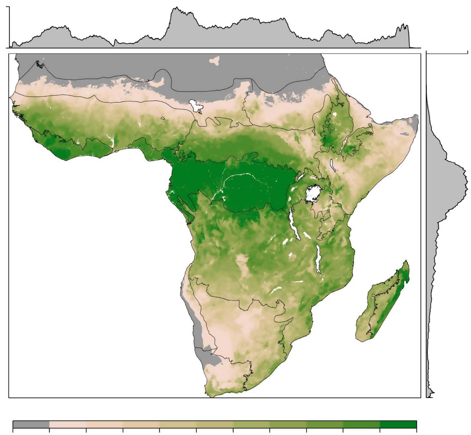
Woody (tree and shrub) cover and biomass across Sub-Saharan Africa at a resolution of 1 km for the period 2000-2004.
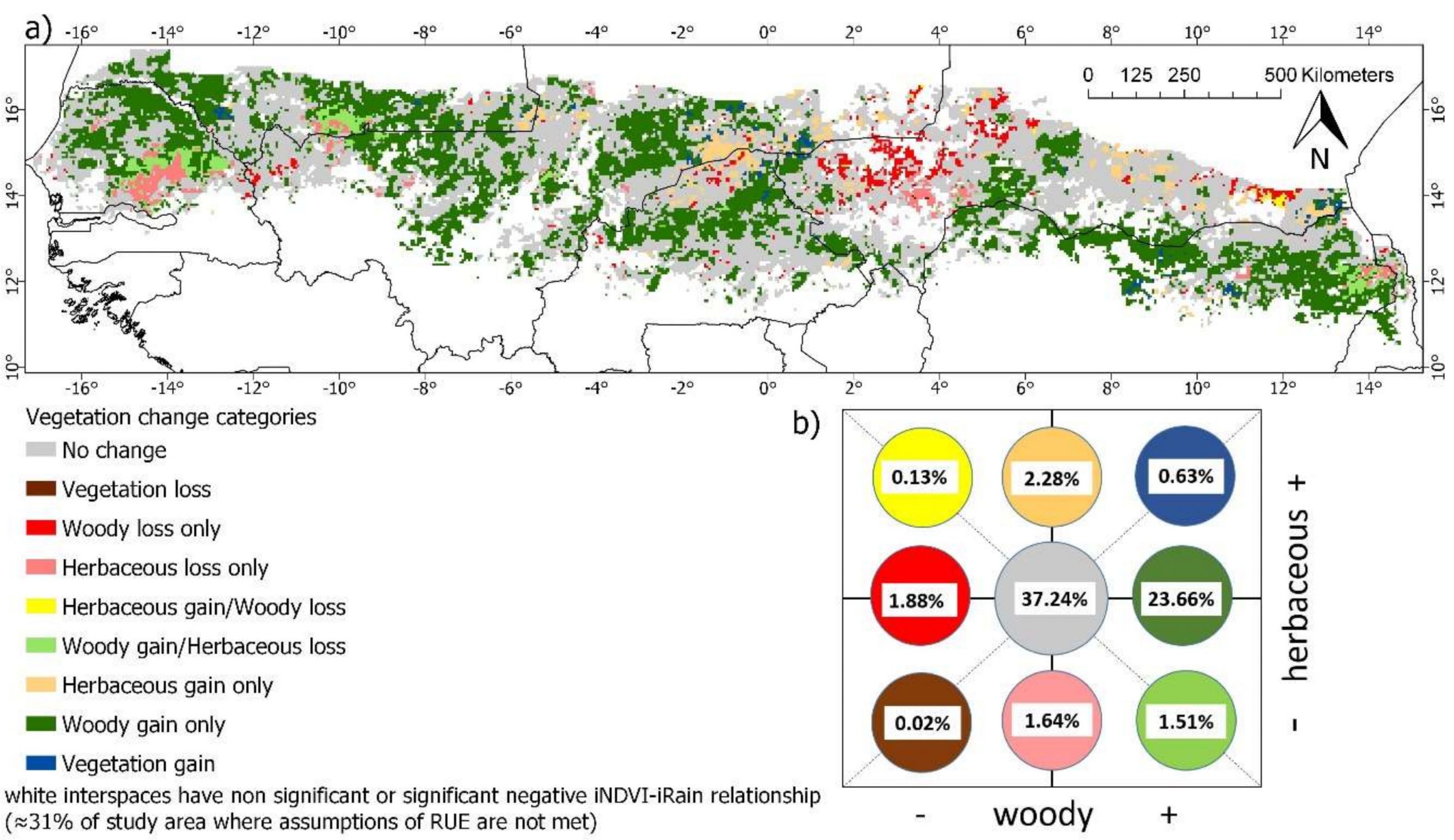
Woody and herbaceous vegetation cover change over the time period 1982-2013 for the West African Sudano-Sahel savanna region at a resolution of 0.05 degrees.
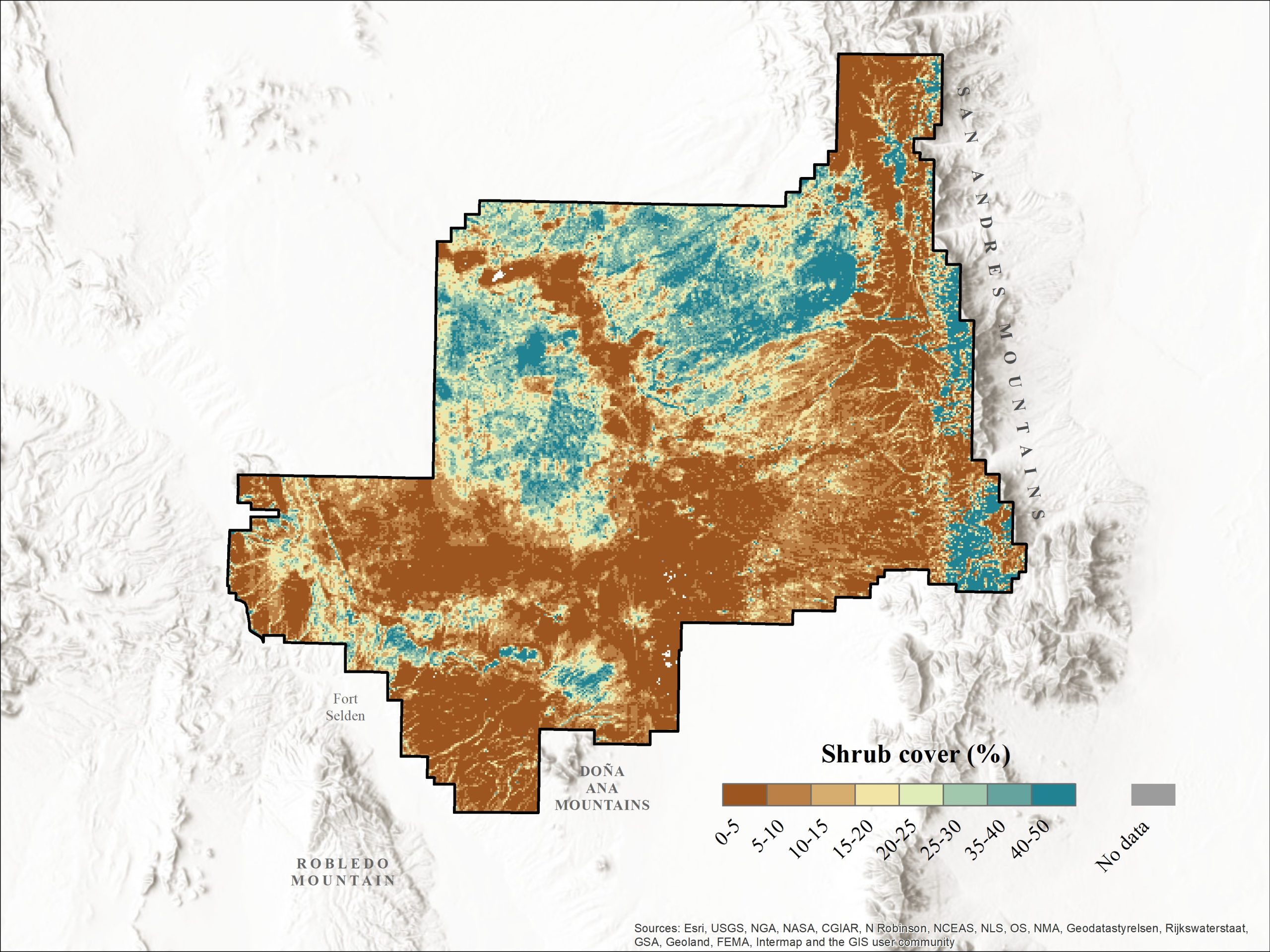
Shrub cover map for the Jornada Experimental Range and Chihuahuan Desert Rangeland Research Center with a spatial resolution of 1 meter.
DOI: 10.6073/pasta/2bbee949ad08c7feb1d5cec6570b65b8
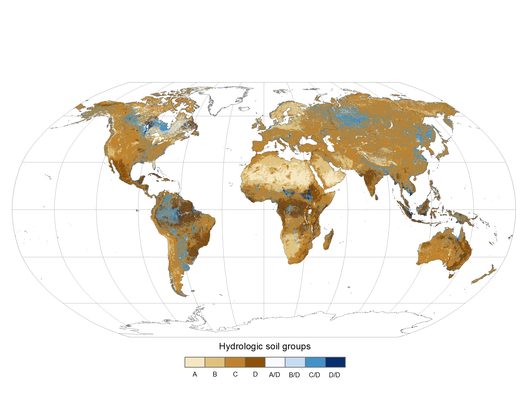
Global gridded hydrologic soil groups (HSGs) with a spatial resolution of 1/480 decimal degrees.
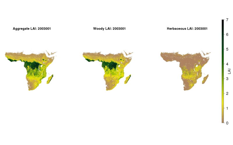
Woody and herbaceous leaf area index for sub-Saharan Africa for years 2003-2015.
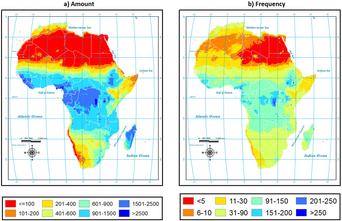
Gridded (0.25 x 0.25-degree) estimates of 14-year mean monthly rainfall total amount (mm), frequency (count), intensity (mm/hr), and duration (hrs) of rainfall over the African continent, including Madagascar, from 1998-2012.
Related publication: Samasse, K., Hanan, N. P., Anchang, J., and Diallo, Y. (2020). Remote Sensing, 12, 1436. doi: 10.3390/rs12091436.
Related publication: Anchang, J., Prihodko, L., Ji, W., Kumar, S.S., Ross, C.W., Yu, Q. et al. (2020). Frontiers in Environmental Science, 8, 4. doi: 10.3389/fenvs.2020.00004.
Woody vegetation properties (i.e. cover, crown size, and density) estimated from very high resolution satellite imagery in African savannas
Related publications:
Responses from 100 household interviews, 20 each from three villages in Mali and 10 each from two villages that were very nearby. Included are responses to questions about the percent of fuelwood purchased versus collected by the household, and, of the percentage collected, the proportion that is cut from live trees versus obtained dead on the ground
Related publication:
Soil and vegetation characteristics, herbivore estimates, and precipitation measurement data for the 854 sites in African savannas
Related publications:
Top-of-the-canopy broadband albedo and radiation fluxes calculated from measurements at the Mongu and Skukuza flux tower sites in southern Africa from March 2000 through December 2002
Related publication:
Meteorological measurements (30-minute averages) from an eddy covariance system mounted on a tower near the Skukuza Camp in Kruger National Park, South Africa from 2000 to 2002
Related publications: